
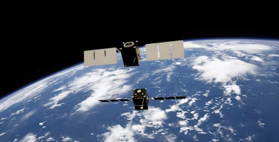
Hedge funds have been using satellite imagery for over a decade — counting cars in retailers’ parking lots before earnings season, tracking crude oil inventories by measuring the shadows inside storage tanks, watching crop conditions ahead of official yield reports. Firms like Orbital Insight and RS Metrics built real businesses selling that edge to institutional investors who could afford it.
What most people don’t realize: the same current satellite images those funds pay analysts to interpret are sitting in free, public tools right now. You can open a real time satellite images Earth view and check a company’s shipping activity, a competitor’s construction site, or a region’s drought risk yourself. Today the barrier is gone, and all the necessary information can be found in public.
Satellite Imagery Isn’t Just for Governments Anymore
Some years ago, information used to arrive filtered through institutions. If you’ve ever typed “how can I see current satellite images” into a search bar after a disaster or a suspicious news claim, you already sensed this. But today you don’t need a press pass or a government contact to check current Earth satellite images yourself — you need a browser and ten minutes.
Real people have already used this, for real reasons:
- Verifying news reports. During the military conflicts around the globe, independent researchers and journalists cross-checked official reports against Maxar and Planet Labs imagery and got the real picture of troop movements or damage assessments. For instance, after the August 2020 Beirut port explosion, satellite before-and-after images settled questions about blast radius and warehouse contents within days.
- Tracking disasters. During the August 2023 Maui wildfires, NASA’s FIRMS (Fire Information for Resource Management System) let anyone — not just emergency services — watch active fire fronts using near-real-time thermal data from MODIS and VIIRS satellites.
- Watching your own hometown. Google Earth’s historical imagery layer lets you travel through decades of the same coordinates. People use it to watch a childhood neighborhood, a coastline erode, or a forest turn into a subdivision.
- Holding industries accountable. Global Forest Watch, run by the World Resources Institute, publishes deforestation alerts using satellite data, and it’s been cited in reporting on illegal logging in the Amazon and Indonesia.
Who’s Actually Behind the Data
None of this exists by accident, and it isn’t free because someone’s being generous. The U.S. Landsat program has run since 1972 as a joint NASA-USGS effort, making it the longest continuous satellite record of Earth’s surface. Landsat data was locked behind paywalls until 2008, when USGS opened the entire archive — that single policy shift is arguably why “free satellite imagery” is a normal phrase today rather than a contradiction.
Another example is the European Space Agency’s Sentinel-2. It is a part of the Copernicus program, launched in 2015 and funded by EU taxpayers as public infrastructure. Commercial players fill the gaps: Planet Labs has a constellation of over 200 satellites capturing daily imagery. The feed is based on a subscription. Maxar, which was already mentioned, also supplies the sub-meter imagery – you can usually see it in news investigations.
How These Websites Actually Work
Nobody downloads a satellite image anymore, and that’s the actual innovation — not the imagery itself, but the delivery. These platforms run on cloud-hosted tile servers: massive raw satellite files get processed once on the provider’s end, cut into small map tiles, and stored ready to stream. Your browser just requests the tiles for what you’re looking at.
Here’s what happens when you open one:
- You pick a location — type a place name or drop a pin, no coordinates needed.
- You choose a date or layer — recent pass, historical archive, or a data layer like fire detection or cloud cover.
- The server renders tiles on demand — only the visible area loads, not the entire planet’s dataset.
- The image displays instantly — no software, no processing on your end, no waiting on a multi-gigabyte file.
That’s the whole reason current satellite images stopped being a specialist’s tool. The heavy computing happens somewhere else, invisibly, before you ever click.
H3: Free Tools Worth Naming
- NASA Worldview — free, no account required, updates most layers daily, built for near-real-time global monitoring.
- Sentinel Hub EO Browser — free tier gives access to the full Sentinel-2 archive at 10-meter resolution.
- Google Earth — free, includes historical imagery going back decades for time-lapse comparisons.
- EOS Data Analytics LandViewer — free tier searches multiple satellite sources (Landsat, Sentinel, and others) from a single interface, with basic analytics tools like NDVI layered on top of the imagery.
What This Means Going Forward
The tools in the article like Worldview, EO Browser, LandViewer, EarthExplorer — cost nothing and take minutes to learn. That’s no longer the obstacle. The obstacle is that most people still think satellite monitoring belongs to hedge funds, defense agencies, or NGOs with grant funding, when in fact a taxpayer-funded Landsat archive and an EU-funded Sentinel constellation have been sitting open since 2008 and 2015, respectively.
Reading a satellite image critically should sit next to reading a balance sheet or a news wire critically — a basic skill, not a specialty. The next time a company claims a factory is operating at full capacity, or a region reports no drought stress, or a conflict zone disputes what happened on the ground, the imagery to check it yourself is already public, and you can check it.